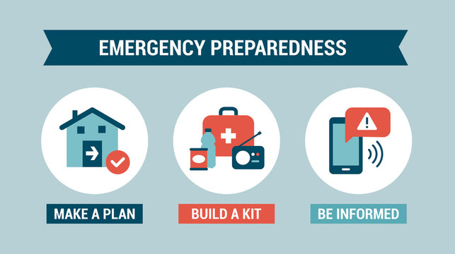
Planning
Plans LCEM Maintain
Click a link below for detailed information.
Person of Contact
John Wieber, OCEM Deputy Director (740) 522-9032
Planning Links
EOP
Under Ohio Administrative Code (OAC) 5502:4-1-01 and compliance with Ohio Revised Code (ORC) 5502.26, countywide emergency management agencies must develop, maintain, and regularly update a county EOP.
- State Review: These plans must be submitted to the Ohio Emergency Management Agency (Ohio EMA) for review and certification to ensure they align with state and federal standards.
- NIMS Compliance: The plan must incorporate the National Incident Management System (NIMS) and the Incident Command System (ICS) structures to ensure local, state, and federal agencies can seamlessly work together.
An Ohio EOP is designed to solve the chaos of a disaster by answering major organizational questions before the event happens:
- Establishes the Basic Plan: Outlines the legal authority, assigns specific responsibilities to county officials (e.g., the Board of Commissioners, Sheriff, EMA Director), and defines how the Emergency Operations Center (EOC) will be activated and operated.
- Organizes by Emergency Support Functions (ESFs): Instead of organizing by agency, Ohio plans typically use the ESF structure. This groups capabilities into specific functions—such as ESF-1 (Transportation), ESF-4 (Firefighting), ESF-8 (Public Health and Medical), and ESF-10 (Hazardous Materials)—so everyone knows who leads and supports specific tasks.
- Resource Management: Details how the county will request, track, and deploy mutual aid, state assets, or private-sector resources when local supplies are exhausted.
- Outlines protocols for critical tasks like public alert and warning (such as Wireless Emergency Alerts), evacuation routes, mass care/sheltering, and how local government will maintain essential services during a crisis.
CANHMP
The CANHMP stands for the Countywide All-Natural Hazard Mitigation Plan. While an Emergency Operations Plan (EOP) is an operational response blueprint used when a disaster hits, the CANHMP is a long-term strategy designed to break the cycle of disaster damage by reducing or eliminating risks before an emergency ever occurs.
Developed locally at the county level (frequently via collaboration between the County Planning Department and the Emergency Management Agency), the CANHMP serves three primary purposes:
Identifying and Profiling Local Risk
The foundational element of a CANHMP is a comprehensive risk and vulnerability assessment. It uses historical data, localized mapping, and modeling to identify exactly which natural hazards threaten the county and its political subdivisions (cities, villages, and townships). Typically, it profiles risks such as:
- Riverine & Flash Flooding: Identifying repetitive loss properties and high-risk flood zones.
- Severe Weather: Analyzing vulnerability to tornadoes, severe summer storms, and high winds.
- Winter Storms: Evaluating the impact of extreme cold, ice, and heavy snow on local infrastructure.
- Geological/Other Hazards: Assessing localized risks like landslides, droughts, or land subsidence.
Securing Federal Grant Eligibility (The Disaster Mitigation Act of 2000)
Under federal law, having a current, FEMA-approved hazard mitigation plan is a strict prerequisite for local governments to receive non-emergency federal mitigation funding.
- Required Updates: The plan must be updated, approved by the Ohio Emergency Management Agency (Ohio EMA) and FEMA Region V, and formally adopted by participating local jurisdictions every five years.
- Funding Pipelines: Maintaining a valid CANHMP ensures the county and its municipalities remain eligible to apply for critical federal grant programs, including the Hazard Mitigation Grant Program (HMGP) and the Building Resilient Infrastructure and Communities (BRIC) program. These grants fund physical projects like buyout programs for flood-prone properties, storm water infrastructure upgrades, and the installation of community safe rooms. This will be subject to change due to the recent FEMA recommendations.
CRS and Flood Insurance Savings
For counties that participate in the voluntary National Flood Insurance Program (NFIP) Community Rating System (CRS), the CANHMP serves a highly practical financial function.
- Because the CANHMP is explicitly written to meet FEMA’s strict CRS standards for flood hazard mitigation planning, it earns substantial “points” for the community.
- These points improve the county’s CRS classification ranking. For example, maintaining a strong plan and delivering required annual progress reports can elevate a county to a Class 7 rating, which automatically translates into a 15% discount on flood insurance premiums for local property owners in participating areas.
- Licking County is a full participant in the NFIP.
Storm Ready Plan
A StormReady Plan isn’t a single standalone document, but rather a formal hazardous weather preparedness framework established by a community or organization to meet the strict certification criteria of the National Weather Service (NWS).
The program was developed by the NWS to help arm communities, counties, universities, military bases, and commercial enterprises with the communication and safety tools necessary to save lives and protect property before, during, and after severe weather events.
Core Requirements to Achieve “StormReady” Status
To be officially certified as StormReady by the local NWS Weather Forecast Office (WFO), a jurisdiction must build out a comprehensive hazardous weather operations plan that satisfies specific criteria across several categories:
- Communication and Warning Hub: Establish a 24-hour Public Safety Answering Point (PSAP) or Emergency Operations Center (EOC) capable of receiving NWS alerts and dispatching public warnings.
- Redundant Receiving Systems: Have multiple, redundant methods to receive severe weather warnings directly from the NWS (such as NOAA Weather Wire, EMnet, Integrated Public Alert & Warning System, or direct NWS Chat).
- Local Dissemination Methods: Maintain multiple ways to alert the public and local agencies immediately when a warning is issued (e.g., outdoor warning sirens, local emergency alert apps, or tone-alert NOAA Weather Radios in critical facilities).
- System Monitoring & Spotter Networks: Actively monitor local weather infrastructure and maintain a localized severe weather monitoring system, which includes a trained network of local SKYWARN® storm spotters.
- Public Readiness & Education: Conduct regular community seminar events, disaster drills, and public safety campaigns to ensure citizens understand localized severe weather risks and safety procedures.
Licking County has been a NWS StormReady certified county since 2017. Pursuing this certification lowers the insurance costs for the county and should provide a reduction to homeowners insurance policies.
Debris Management Plan
This plan is currently under creation due to the state requiring a plan to be in place in each county prior to the end of 2026.